Geography of the Pitcairn Islands
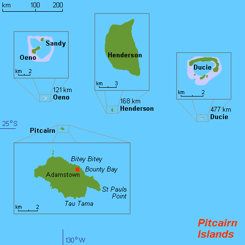
Geography of the Pitcairn Islands
No account needed. By playing, you confirm you're 13 or older and agree to the Terms of use.
No owners yet
Category: Empty
- 0 owners
- 0 copies
- 0 pulls
- Wishlisted
- 0
- In 0 albums
- On 0 showcases
- Market listings
- 0
Not sold on the market yet.
Readers' pathsAug 2026 – Oct 2026
Readers go next to
Share of the 395 clicks on its links

Henderson Island (Pitcairn Islands)
Largest of the Pitcairn Islands, British Overseas Territories.
23%

Pitcairn Islands
British Overseas Territory in the South Pacific.
22%

Pitcairn Island
Only inhabited island in the Pitcairn Islands, British Overseas Territories.
18%

Oeno Island
Atoll in the Pitcairn Islands, British Overseas Territories.
11%

Ducie Island
Atoll in the Pitcairn Islands, British Overseas Territories.
8.6%

Bounty Bay
Bay on Pitcairn Island.
6.3%
Pawala Valley Ridge
Highest point of Pitcairn Island.
5.6%
Readers come from
Share of the 822 readers arriving from another article
